|
REFINE
Browse All : Images of England: Greater Manchester: ManchesterParent Work Title
Registration Sub-District. Ancoats. Sanitary District No. 11
Reference Number
C17:70 Manchester (23)
Parent Work Title
Registration Sub-District. Ancoats. Sanitary District No. 10
Reference Number
C17:70 Manchester (23)
Parent Work Title
Registration Sub-District. Ancoats. Sanitary District No. 9
Reference Number
C17:70 Manchester (23)
Parent Work Title
Registration Sub-District. Ancoats. Sanitary District No. 8
Reference Number
C17:70 Manchester (23)
Parent Work Title
Adshead's twenty four illustrated maps of the township of Manchester: divided into municipal wards: Corrected to the 1st. May, 1851
Reference Number
C17:70 Manchester (22)
Parent Work Title
Adshead's twenty four illustrated maps of the township of Manchester: divided into municipal wards: Corrected to the 1st. May, 1851
Reference Number
C17:70 Manchester (22)
Parent Work Title
Adshead's twenty four illustrated maps of the township of Manchester: divided into municipal wards: Corrected to the 1st. May, 1851
Reference Number
C17:70 Manchester (22)
Parent Work Title
Registration Sub-District. St. George's. Sanitary District No. 4
Reference Number
C17:70 Manchester (24)
Parent Work Title
Manchester and Salford. Sheet 42, 1851
Reference Number
C17 (6)
Parent Work Title
Manchester and Salford. Sheet 16, 1850
Reference Number
C17 (6)
Parent Work Title
Registration Sub-District. St. George's. Sanitary District No. 6
Reference Number
C17:70 Manchester (24)
Parent Work Title
Adshead's twenty four illustrated maps of the township of Manchester: divided into municipal wards: Corrected to the 1st. May, 1851
Reference Number
C17:70 Manchester (22)
Parent Work Title
Registration Sub-District. St. George's. Sanitary District No. 5
Reference Number
C17:70 Manchester (24)
Parent Work Title
Manchester and Salford. Sheet 33, 1851
Reference Number
C17 (6)
Parent Work Title
The Manchester Ship Canal: Manchester Docks
Reference Number
C17:41 (24)
Parent Work Title
Adshead's twenty four illustrated maps of the township of Manchester: divided into municipal wards: Corrected to the 1st. May, 1851
Reference Number
C17:70 Manchester (22)
Parent Work Title
Adshead's twenty four illustrated maps of the township of Manchester: divided into municipal wards: Corrected to the 1st. May, 1851
Reference Number
C17:70 Manchester (22)
Parent Work Title
Registration Sub-District. St. George's. Sanitary District No. 11
Reference Number
C17:70 Manchester (24)
Parent Work Title
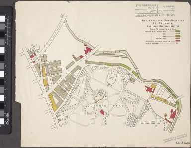
Registration Sub-District. St. George's. Sanitary District No. 10
Reference Number
C17:70 Manchester (24)
Parent Work Title
A plan of Manchester & Salford: drawn from an actual survey by William Green: begun in the year 1787 and compleated in 1794
Reference Number
C17:70 Manchester (12)
Parent Work Title
Registration Sub-District. St. George's. Sanitary District No. 9
Reference Number
C17:70 Manchester (24)
Parent Work Title
Registration Sub-District. St. George's. Sanitary District No. 8
Reference Number
C17:70 Manchester (24)
Parent Work Title
Registration Sub-District. St. George's. Sanitary District No. 7
Reference Number
C17:70 Manchester (24)
Parent Work Title
Manchester and Salford. Sheet 41, 1851
Reference Number
C17 (6)
Parent Work Title
Manchester and Salford. Sheet 49, 1850
Reference Number
C17 (6)
Parent Work Title
Manchester and Salford. Sheet 23, 1850
Reference Number
C17 (6)
Parent Work Title
Manchester and Salford. Sheet 8. 1850
Reference Number
C17 (6)
Parent Work Title
Port of the Manchester docks
Reference Number
C17:41 (22)
Parent Work Title
Adshead's twenty four illustrated maps of the township of Manchester: divided into municipal wards: Corrected to the 1st. May, 1851
Reference Number
C17:70 Manchester (22)
Parent Work Title
Adshead's twenty four illustrated maps of the township of Manchester: divided into municipal wards: Corrected to the 1st. May, 1851
Reference Number
C17:70 Manchester (22)
Parent Work Title
Bacon's commercial & industrial map of Lancashire showing railways, roads elevations & distances : also local government divisions including parishes with acreages
Reference Number
C17:37 (15)
Parent Work Title
Bacon's Plan of Manchester
Reference Number
C17:70 Manchester (21)
Parent Work Title
"Geographia" plan of Manchester
Reference Number
C17:70 Manchester (28)
Parent Work Title
Manchester and Salford. Sheet 48, 1850
Reference Number
C17 (6)
Parent Work Title
Bacon's large scale plan of Manchester
Reference Number
C17:70 Manchester (21)
Parent Work Title
Manchester and Salford. Sheet 1, 1850
Reference Number
C17 (6)
Parent Work Title
Manchester and Salford. Sheet 5, 1850
Reference Number
C17 (6)
Parent Work Title
Manchester and Salford. Sheet 30, 1851
Reference Number
C17 (6)
Parent Work Title
Manchester and Salford. Sheet 37, 1851
Reference Number
C17 (6)
Parent Work Title
Adshead's twenty four illustrated maps of the township of Manchester: divided into municipal wards: Corrected to the 1st. May, 1851
Reference Number
C17:70 Manchester (22)
Parent Work Title
Manchester and Salford. Sheet 7, 1850
Reference Number
C17 (6)
Parent Work Title
Map showing the course of the Proposed Manchester Ship Canal
Reference Number
C17:41 (40)
Parent Work Title
Manchester and Salford. Sheet 32, 1850
Reference Number
C17 (6)
Parent Work Title
Adshead's twenty four illustrated maps of the township of Manchester: divided into municipal wards: Corrected to the 1st. May, 1851
Reference Number
C17:70 Manchester (22)
Parent Work Title
The Manchester Ship Canal: Manchester Docks traffic arrangements
Reference Number
C17:41 (26)
Parent Work Title
Adshead's twenty four illustrated maps of the township of Manchester: divided into municipal wards: Corrected to the 1st. May, 1851
Reference Number
C17:70 Manchester (22)
Parent Work Title
Manchester and Salford. Sheet 39, 1851
Reference Number
C17 (6)
Parent Work Title
Manchester and Salford. Sheet 12, 1850
Reference Number
C17 (6)
Parent Work Title
Manchester and Salford. Sheet 4, 1850
Reference Number
C17 (6)
|


